The Popularization Ideal of DJI Drones
 2024-01-06
view:61
2024-01-06
view:61
In 2013, an oil and gas station in the United States caught fire. At this time, the fire was very close to the oil tank, but firefighters far away from the fire were worried that the thermal power could cause the oil tank to explode, resulting in all casualties. At this moment, the on-site firefighters took out DJI drones and flew over. They saw that the fire was still a safe distance from the oil tank, so they entered the area and began trying to extinguish the fire.
In 2013, DJI DJI launched the Elf Phantom 2 innovative all-in-one aircraft, which led vertical takeoff and landing multi rotor drones from the "toy era" to integrated products. This time, users used Elf drones for fire rescue. DJI discovered that drones can not only be a consumer grade aerial photography product, but also be applied in the fire industry to prevent accidents, assist in quick decision-making, and safely rescue trapped people.
Although DJI has not publicly disclosed its revenue situation in the past two years. However, according to relevant market research, in the consumer grade drone market, DJI City has accounted for as much as 70%, becoming a full industry leader. However, according to Frost&Sullivan's forecast, the consumer grade drone market is expected to grow by only 2 times from 2019 to 2024, while the industrial grade drone market can grow by 10 times.
Based on the growth calculation of the drone market, 36Kr learned that as early as 5 years ago, DJI had made advance layouts in multiple fields such as agriculture, industry, and automotive. Within DJI, consumer grade, vehicle mounted, industry drones, and agricultural drones are each independent BUs.
Growth rate of industrial drone market
In terms of gameplay, industry customers are naturally different from the mass market of consumer grade drones. Industrial specification products are more complex than consumer electronics specifications, and in order to meet specification standards, they must be able to solve practical industry problems. DJI needs to be closer to B-end consumers and redefine a "new species" that is different from consumer grade drones for applications in industries such as fire protection, law enforcement, and surveying.
Market segmentation of industrial drones
In the early days of DJI, some products were developed, which was a bit like crossing a river by feeling a stone. Later, when it came to industrial grade drones, they had to enter the front line. For example, the research and development of applications in the DJI industry, as well as frontline employees, are required to go to the front line for experience after joining. Employees in the emergency management industry are responsible for conducting drone rescue exercises in the mountains every month to experience the rescue process.
In fact, what is rarely known to the outside world is that while DJI has released new consumer grade drone products, DJI's industry grade drones have also formed their own stable product line. Since 2017, a series of releases have been released, including the Jingwei M200 drone, Mavic 2 industry version, Jingwei 300RTK drone, Jingwei M30, Mavic 3 industry version, etc.
The application of industry drones in the agricultural field has formed product sequences and supporting software systems such as T40, T30, T25, T20, and T10 according to different load capacities.
36Kr once interviewed industry insiders in the consumer grade drone industry, stating that since DJI's Phantom and Mavic series, it is difficult for consumer grade drones to innovate in a transformative manner. Industry level drones rely more on technology to meet actual user needs and win steadily, building upon existing needs. DJI is making the industry's drones smaller in size, more functional, more stable, and faster to get started.
Industry level drones, the next growth point of DJI
After achieving centimeter level accuracy in drone aerial surveys, it gradually penetrated the industry.
After the "3.21" incident of China Eastern Airlines this year, Zhang Xueliang, the head of the DJI Emergency Alliance, brought a drone to the scene. Someone on site asked, what can drones do? In fact, upon arriving at the scene, Zhang Xueliang discovered that after the plane crash, it was necessary to measure each scattered piece of debris to restore the accident scene, while not damaging the on-site environment. Due to the scattered fragments in the valley, manual measurement with a tape measure is very time-consuming.
On the day of arrival, when it was dawn, they flew a drone to the scene for digital image acquisition. After taking on-site photos, the drone used "Sikong 2" software to measure the distance, square meters, and cubic meters from point to point, and finally restored the location of each fragment.
Similar practical actions occurred as early as 2015, when post earthquake Nepal needed reconstruction. At this time, DJI had not yet launched its own industry drone, the M200 (released in 2017). Personnel from DJI headquarters rushed to the disaster site with consumer grade drones to provide urban mapping for the local area, assist in post disaster rescue, personnel deployment, and post disaster urban reconstruction.
It is worth noting that in order to better coordinate rescue work, in 2020, DJI mobilized interested agents internally to join the DJI Emergency Alliance organization. Now, there are 40 emergency alliance organizations covering 26 provinces, participating in 100 emergency rescue incidents every year.
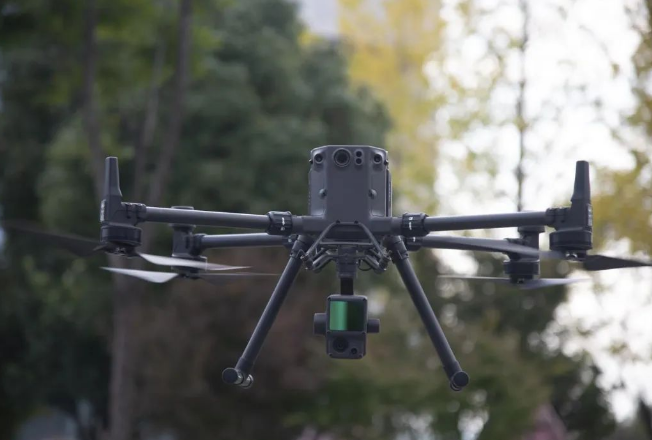
In early November, 36 Kr followed the DJI industry application team and firefighters to the northern mountains of Kunming to participate in an emergency rescue simulation operation. When searching for people, firefighters used the DJI M30T drone, which is compact and convenient and can be deployed at any time. The core camera module combines functions such as wide-angle, zoom, thermal imaging, laser ranging, and is equipped with a speaker.
Longitude and latitude M30T equipped with a loudspeaker
Therefore, during rescue, the pilot can pull up the camera at high altitude to determine the coordinates of the rescue personnel. Secondly, if it is night rescue, the thermal imaging function can maximize its effectiveness. When there is a strong temperature difference between the human body and the surrounding environment, drones are more accurate in identifying rescue targets.
Drone infrared thermal imaging function (white heat mode) detects rescue targets
In 2017, DJI released the industry application unmanned aerial vehicle (UAV) M200 series, officially entering the industry level UAV market. A fire safety insider stated at this internal sharing meeting that after the Shouguang flood in 2018, they uploaded the drone's 2D image to their internal system, making it a fire protection application. In the future, firefighting will continue to increase rescue demand. Roughly estimated, each firefighting brigade will have at least 100 drones on average, and this number will double this year.
The development path of the drone industry
This fire insider stated that future unmanned combat equipment can be achieved at rescue sites. But three requirements have been proposed from the equipment side: first, high altitude, long endurance, and heavy load require stable motor and power; Secondly, task automation and airport platformization; Thirdly, the clustering of bees will benefit SLAM technology for autonomous flight.
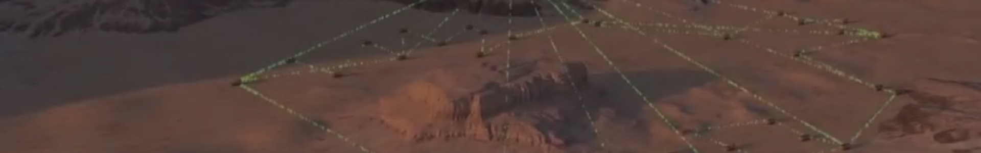
In addition to emergency rescue, geographic surveying and mapping is another major application point of drones in the industry. Deng Kaiqiang, Senior Solution Engineer for Application Surveying Products in DJI Industry, introduced that after taking 10000 photos of Jiayuguan using DJI drones, the 3D model can restore the actual environment. In the competition "Protection of Ancient Architecture and Cultural Relics" held in DJI, a contestant used Elf 4 to complete a survey of the 3000 kilometer Cangling Ancient Road within a 2-day flight time.
In the surveying and mapping industry, Li Yushu from the Application Marketing Department of DJI Industry introduced to 36Kr that mechanical shutter and RTK (a spatial positioning technology) are the core technical requirements of industry level customers. In the past, surveying and mapping personnel often used DJI M600 equipped with a DSLR camera for their work, and also needed to set up image control points on the ground (a surveying and mapping positioning method) to accurately capture images. Nowadays, the built-in mechanical shutter of drones can reduce motion blur and ensure operational accuracy during high-speed operations; And the RTK network can accurately locate, eliminating the laborious work of setting up image control points on the road surface. So as to assist surveying and mapping workers in completing a "simple" surveying and mapping work on the software side, based on thousands and thousands of photos.
Not only did it protect cultural relics and measure glaciers, but drones also participated in the construction of a realistic 3D China (building China's 3D Google map). Four drones established a realistic model of Dongguan (2400 square kilometers) in just one month.
Not only in firefighting and geographic surveying, industry drones also cover multiple application fields such as agriculture, forestry and plant protection, and power inspection. Drone aerial surveys replacing manual modeling, and "industrial drones+unmanned airports" replacing manual operations may become a future trend.
Demand stimulates supply, and the future market growth rate of industrial grade drones is relatively fast. Based on the predictions of CITIC Securities and Frost&Sullivan, the proportion of agricultural and forestry plant protection, surveying and geographic information, and inspection in downstream applications of industrial drones is currently the highest. In 2019, the market size of agriculture, forestry and plant protection, surveying and geographic information, and inspection reached 4.7, 3.4, and 2.9 billion yuan, respectively. By 2024, it is expected to achieve a market size of 319, 449, 122, 256, and 19.8 billion yuan.
The Popularization Dream of DJI Drones
After entering the surveying and mapping industry in 2019, DJI pointed out the popularization of aerial surveying.
Deng Kaiqiang stated that firstly, the price should be made more affordable. In the past, drone surveying and aerial survey work often cost millions of yuan, but now the cost of a drone ranges from tens of thousands to hundreds of thousands; Secondly, there is the popularization of technology. In the past, aerial survey workers had to undergo extensive training and spend a week learning software and drone flight operations. But now, drones are miniaturized, simple to use, and easy to get started with; Finally, the application of civilian technology and results can be applied in scenarios such as architecture, forestry, water conservancy, transportation, and emergency rescue, in addition to traditional surveying and mapping units.
Hou Zhiqun, the director of Kunming Surveying and Mapping Research Institute, introduced to 36Kr that previously, the surveying and mapping industry mostly used helicopters, or throwing fixed wing drones and vertical takeoff and landing fixed wing drones, but these products were expensive and inconvenient to use. Multi rotor aircraft are more tolerant of takeoff and landing locations, making them the most unique competitive advantage compared to other aircraft models.
M300 RTK equipped with Zen L1
How does DJI balance and consider technology, products, business, and innovation?
Compared to vertical takeoff and landing, DJI has yet to launch fixed wing unmanned aerial vehicle models, which is also related to the company's positioning. Sam, the product manager of DJI, explained to 36Kr, "DJI does not lack this technical capability, but the requirements for the site determine its high cost, difficulty in use, and very niche. It is difficult to form a scale before achieving ease of use." This goes against DJI's development logic.
Sam stated that for many product forms, DJI has explored and attempted internal technologies. But before DJI commercializes its technology, there will be many "thresholds" set internally. "We will consider at every level whether the product can truly bring benefits to customers and whether it can transform the industry.".
It is worth mentioning that DJI has launched an unmanned airport this year, but this project had pre research and engineering prototypes within DJI 10 years ago. Before launching the productization project for unmanned airports, the DJI industry team conducted research and found that some flagship unmanned airports weigh one ton but sell for over 1 million yuan and require a maintenance staff. "This actually loses the significance of unmanned airports themselves. Practicality and cost-effectiveness are the product trends of unmanned airports."
DJI hopes that unmanned airports can be maintenance free for 6 months, with complete functions and business flow, providing key data every day, and even users ignoring the existence of the airport. The cautious launch of products also represents that DJI has recognized itself as a mature commercial company.
Sam added to 36Kr that there are two core principles for the development of DJI industrial grade drone products: first, to make drones widely used and generate universal social value; The second is that the product is easy to use and stable. Specifically, in terms of product strategy, firstly, it provides simple, reliable, and easily obtainable productivity tools like electric screwdrivers; secondly, it ultimately achieves unmanned operation in repetitive labor scenarios.
Previous:Nothing
Next:Nothing
Co.,LTD")


 Phnom Penh City Garden I09/01 Sen Sok District Phnom Penh City
 Sargeras2024@gmail.com
 +855 975799817